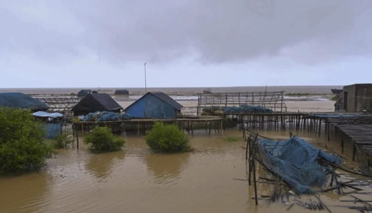
Cyclone Dana: Landfall continues, heavy rains batter Odisha & Bengal, Bhubaneswar airport resumes services
Bhubaneswar: The landfall process of severe cyclonic storm ‘Dana,’ which began shortly after midnight, is ongoing, with the rear sector of the system now moving inland, the India Meteorological Department (IMD) said on Friday morning.
According to the IMD, the landfall process will continue for another hour. The severe tropical system struck the northern Odisha coast near Habalikhati Nature Camp in Bhitarkanika and Dhamara, with wind speeds ranging from 100 to 110 km/h and gusts reaching up to 120 km/h.
The cyclone triggered heavy rains and strong winds across the coastal districts of Kendrapara, Bhadrak, and Balasore.
While no major damage has been reported so far, uprooted trees were observed in Kendrapara and Bhadrak districts. The National Disaster Response Force (NDRF), Odisha Fire and Emergency Service, and Odisha Disaster Rapid Action Force (ODRAF) are working to clear affected roads by cutting down uprooted trees.
“Uprooting of trees was reported in places such as Rajnagar, Pattamundai, Dhamara and Basudevpur. Fire personnel are cutting the damaged trees and branches to clear the roads at the earliest,” said Fire Services DG Sudhanshu Sarangi.
The state government has already evacuated 5.84 lakh people to cyclone shelters, as Dana is predicted to affect three districts with wind speeds of up to 120 km per hour.
Flight operations at the Biju Patnaik International Airport (BPIA) in Bhubaneswar resumed on Friday morning as weather conditions improved. The airport operation was suspended from 5 pm on October 24 in view of cyclone Dana. The services resumed at 8 am, according to BPIA Director Prasanna Pradhan.
Meanwhile, cyclone Dana moved in a north-northwest direction at a speed of 10 km/h over the past six hours, lying over north coastal Odisha, about 30 km north-northwest of Dhamara and 50 km north-northwest of Habalikhati Nature Camp as of 6:30 am.
The system is expected to continue moving northwest across north Odisha and gradually weaken into a cyclonic storm by late morning. It remains under continuous surveillance by the Doppler weather radar in Paradip, according to the IMD.
The IMD said at 8.23 am that the “landfall process continues and the rear sector of the cyclone is entering into the land. The landfall process would continue for the next 1-2 hours. The system is likely to move nearly northwestwards across the north of Odisha and weaken gradually into a cyclonic storm by the forenoon of October 25.”
The NDRF and ODRAF teams on Friday started restoration work by removing uprooted trees from the roads in the coastal districts of Odisha even as the landfall process of severe cyclonic storm Dana is still going on, an official said.
Odisha Higher Education minister Suryabanshi Suraj, who is in charge of Bhadrak district, said there was no report of any casualty in the district.
“There is no report of any casualty. There has been massive damage to electrical installations due to tree falling. Roads are being cleared,” the minister said The NDRF and ODRAF teams started work despite gusty winds and heavy rainfall in Dhamra area of Bhadrak district.
The Tehsildar of Rajnagar in Kendrapada district, Ajay Mohanty, said that there has been no major damage in the Bhitarkanika area except uprooting of some trees and damage to some thatched houses.
“The wind speed has substantially come down to 80 to 90 kmph, but the rain continues to lash the area,” Mohanty said, adding that seawater has entered into some water bodies and low-lying areas during the tidal surge on Thursday night. Chandabali in Bhadrak received the highest rainfall of 131.6 mm during the last six hours, followed by 42.8 mm in Balasore, an official said.
Odisha Chief Minister Mohan Charan Majhi was reviewing the cyclone situation at the office of the Special Relief Commissioner.
The coastal districts of Bhadrak, Kendrapara, Balasore and nearby Jagatsinghpur district witnessed a sudden increase in wind speed which reached 100 kmph to 110 kmph and extremely heavy rain during the landfall process.


Comments are closed, but trackbacks and pingbacks are open.